 |
| Two Head Cow, Taken By Me(: |
Wednesday, April 6, 2011
Spring Break
During Spring Break I went too Seattle and saw some family, but while I was there I went too the markets. While we were there we went to this one place were they had dead people and like two headed cows and bigs. It was awesome, but really creepy. When we got back from are trip in Seattle, I came down with a really bad flu. So I didn't do much as I wanted too do during Spring Break.
Wednesday, March 9, 2011
Native Americans Coastal vs. Plateau
 |
| http://hubpages.com/hub/Native-Coastal-and-Plateau-North-Americans---Similarities-and-Differences |
Out of the Coastal and Plateau Tribes I think I would pick the Coastal Tribe. I think this because on the the Coastal side you live right by the ocean so you don't have to walk far to get food, other then the Plateau side you would have to go up mountains and hills just to find food. Another thing would be you wouldn't have to wear shoes and they don't wear leather. Also the way they traveled was by canoe and that would be a lot easier then having to worry about feeding horses or walking really far distances. So that's a few reason why I would rather live in the Coastal Tribe then the Plateau Tribe.
Thursday, March 3, 2011
Native American Route
 |
| http://www.oldhalifax.com/county/NativeAmericanIndians.htm |
No one nos for sure how the Native Americans came to North America, but there are three possible ways. Those are Land Bridge, Ice Bridge, and Continental Shelf. The Land Bridge is when the water sunk and you could walk on the land that was left. The Ice Bridge was when all the water frooze after the ice age, and it was hard enough for them to walk across. Last one was the Continental Shelf its when the lands were together by a small path with water on both of the sides. The one that I think was the one they used was the Continental Shelf, because there has to be a time when though two lands were together. So they could have talked over it before the two lands split.
Thursday, February 24, 2011
Quiz Scores
Getting Started -> 100% FBCAL
Staying Safe -> 100% MHRAC
Using Your Browser -> 100% QRPXT
Searching Online -> 100% AZLMP
Trying Top Tricks -> 100% VNYRW
I know alot about the internat but what i did learn was how to search things on the internat better. Thats important for if you need to find straight fakes for something or just wanna know something.
Thursday, February 17, 2011
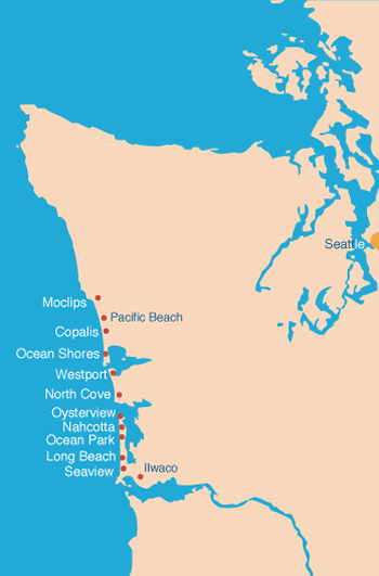
What sub region would you want to live in?
 |
| By: http://yachtpals.com/node/394 |
Out of all the 7 regions I would wanna live in the Coastal Region. I would wanna live there because they have high mountains called the Olympics, and they are 8,000 feet high. Another thing is they have two rivers the Willapa Bay and Grays Harbor and it would be fun to swimming and fishing in them over the summer. Also whats great about this region is, is that there is two main climates. One of them is were it can get really snowy and rainy and the other it can get mild and not too hot and I do not like to get too hot. Another great thing about this region is they have rain forest's, and in rain forest's they have pretty flowers and alot of animals. So all together I think the Coastal Region would be the best because of the nice rivers, mountains, and it would never get too hot.
Thursday, February 10, 2011
The Rain Shadow Of Washington State
 |
| By: http://scienceinmyfiction.com/2010/04/23/worldbuilding-with-real-worlds/ |
To start off the rain shadow has a few main parts. First, the rain shadow starts when water gets evaporated, then goes up the windward part of a mountain. After it rains on that side, whatever is left goes down the leeward side of the mountain and this happens over and over again. But the main thing about the rain shadow is how it affects are economy. On the windward side of the mountains is were most of the high jobs are like fishing for like food, growing food and animal life because of the rain and forests. On the leeward side of the mountain is were most of the factory's, and other things that don't rely on much water because that side doesn't get as much rain to make food or other things we need. So each both of the sides has a huge part in how are state works. From weather pages.com it states how the rain shadow effects us and how it helps us. So in the end the rain shadow can us in many ways.
Thursday, February 3, 2011
Glaciers That Altered Washington State

Subscribe to:
Comments (Atom)